Escaped youth tracked by Eagle helicopter, found hiding in New Brighton
The young person who escaped from a youth justice facility in Rolleston has been located...


The young person who escaped from a youth justice facility in Rolleston has been located...

A person has been seriously injured on State Highway 75, Christchurch Akaroa Road. A police...

BodyFix Gym Christchurch in Phillipstown has taken out two major honours at the Exercise New...

Local MPs have found areas of agreement on major Resource Management Act reforms, during a...

A series of public events have been organised across Christchurch and Lyttelton over the coming...

A woman was taken to hospital after a ‘water incident’ at Parakiore Recreation and Sport...
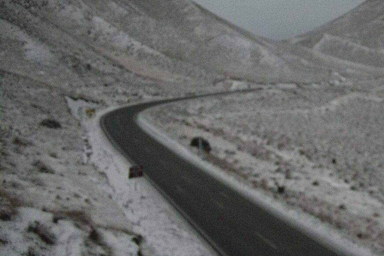
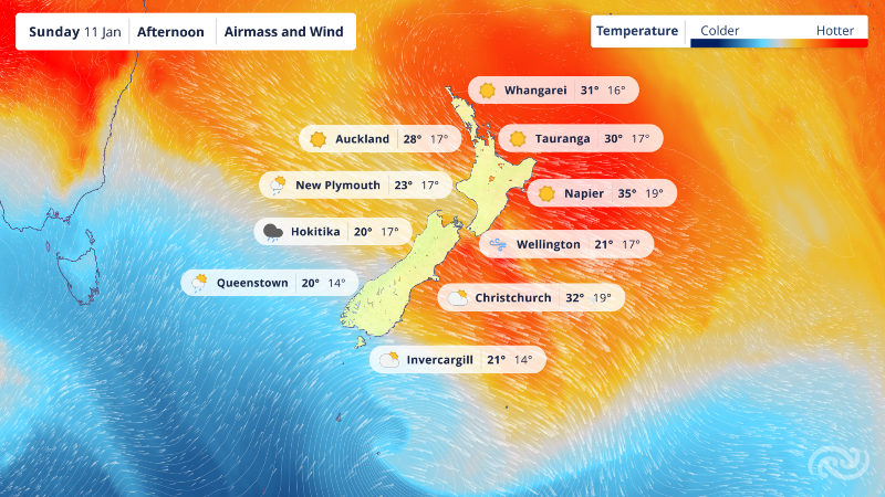
Colder air will arrive over the region tomorrow with some light snow flurries possible.
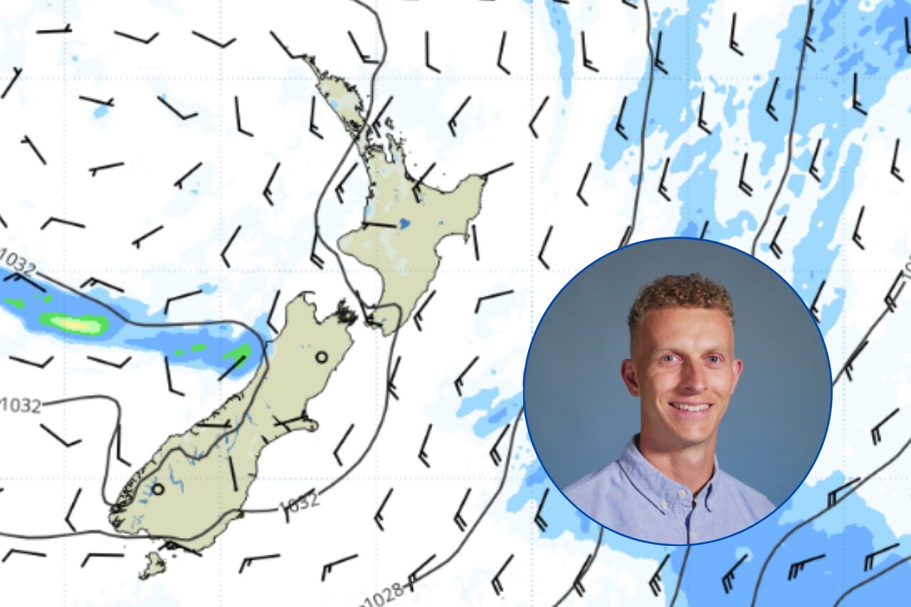
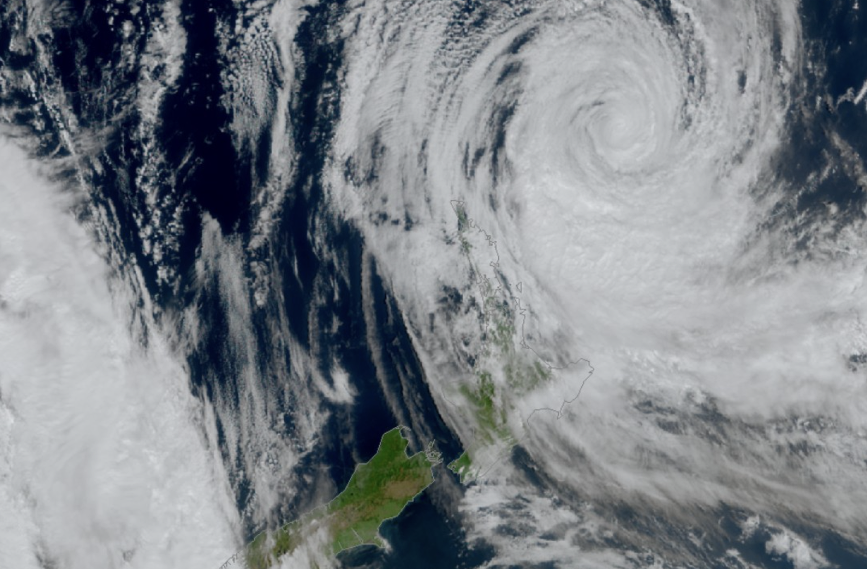
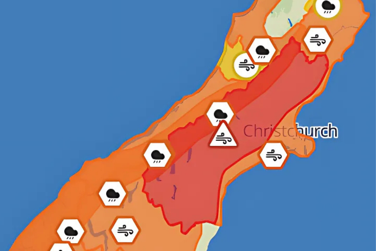
A much more active weather system will arrive next weekend bringing with it a complicated and currently uncertain period of significant weather according to Blue Skies Weather & Climate Services Ltd.
For farmers, expect a few light snow flurries above 500m tomorrow afternoon and evening, with little if any accumulation.
Tuesday is currently looking fine and cold.
Blue Skies Weather and Climate Services Forecaster Tony Trewinnard said the period from this Friday through Wednesday of the following week will be highly changeable and stormy, with a low risk of a high impact snow event (or two) for many parts of the South Island.
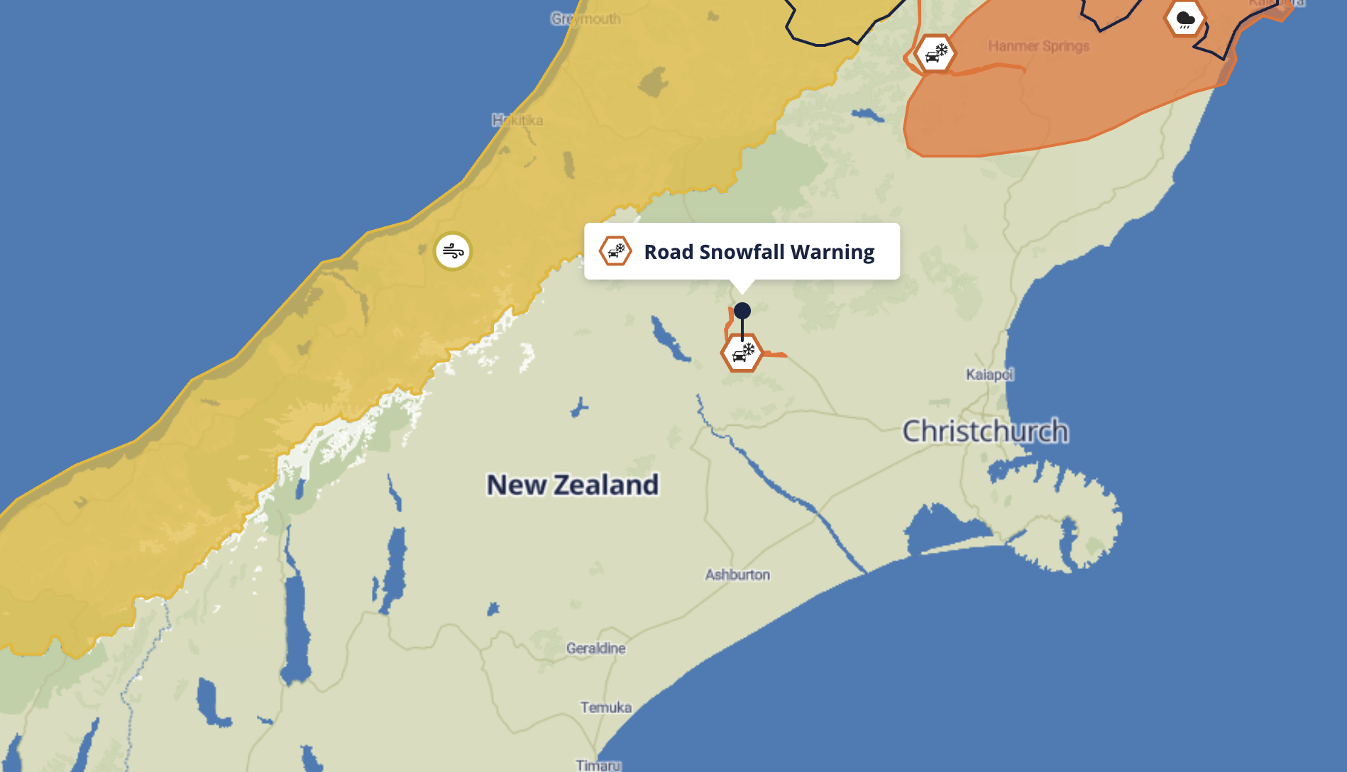
However, the current expectation is for milder weather and rain in the early part of the period, and only light snow showers later, with no solid indication of a severe (or low level) event being likely. Best to stay ready though, as there are risks there and the model guidance does hint at some (low probability) severe outcomes.
Travel is likely to be impacted by severe weather at times between about Friday and next Wednesday. If you are planning travel at this time it would pay to be flexible, and ready for possible delays or complications.