Escaped youth tracked by Eagle helicopter, found hiding in New Brighton
The young person who escaped from a youth justice facility in Rolleston has been located...
Proudly powered by VAST – NZ’s leading digital advertising billboard company. FIND OUT MORE

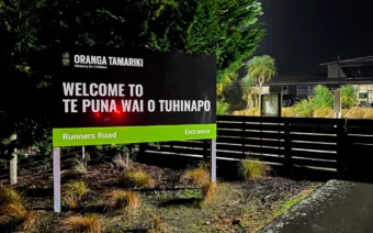
The young person who escaped from a youth justice facility in Rolleston has been located...

A person has been seriously injured on State Highway 75, Christchurch Akaroa Road. A police...

BodyFix Gym Christchurch in Phillipstown has taken out two major honours at the Exercise New...

Local MPs have found areas of agreement on major Resource Management Act reforms, during a...

A series of public events have been organised across Christchurch and Lyttelton over the coming...

A woman was taken to hospital after a ‘water incident’ at Parakiore Recreation and Sport...
Canterbury has been drenched over the past few days, with parts of the region experiencing record-breaking rainfall, but the worst is over and a more settled weekend is ahead.
MetService meteorologist Mmathapelo Makgabutlane said the region had endured significant rainfall.
“What we’ve seen over the last couple of days since the beginning of Wednesday is quite a lot of rain. And I think the stats really tell the story,” she said.
“Across the Canterbury region, from the start of Wednesday to today, Friday around midday, we’ve seen around 100 to 200 millimetres of rain across the region. However, some spots, especially out towards Banks Peninsula, have seen more than that, closer to about 300 millimetres of rain.”
Makgabutlane said Christchurch had experienced a milestone event.
“Christchurch actually saw its wettest April day on record, and those records go back to about 1943, so quite a long time. That was 80 millimetres in 24 hours.”
Ashburton was also significantly affected.
“Their records only go back to about 2006, so we’re only looking at about 19 years or so, but they had their wettest day on record, as well as their wettest April throughout that record as well,” she said.
Looking ahead, Makgabutlane said the weekend would bring welcome relief.
“Saturday opens up to beautiful sunny skies,” she said. “I was looking at the sunshine data not too long ago, and excluding Monday, this week has seen less than an hour of sunshine in Christchurch. So I’m sure people are ready for some sunshine roundabout now.”
She said the fine weather would hold through Saturday, before some showers arrived overnight.
“As evening rolls around and overnight into Sunday, we do see some passing showers. Nothing too hectic, but maybe some showers in the Canterbury Plains as well as Banks Peninsula as we head into Sunday.”
“Little bit more cloudy skies ahead. Not too much in terms of rain or showers or that in that regard, but overall, a more settled weekend ahead.”