Escaped youth tracked by Eagle helicopter, found hiding in New Brighton
The young person who escaped from a youth justice facility in Rolleston has been located...


The young person who escaped from a youth justice facility in Rolleston has been located...

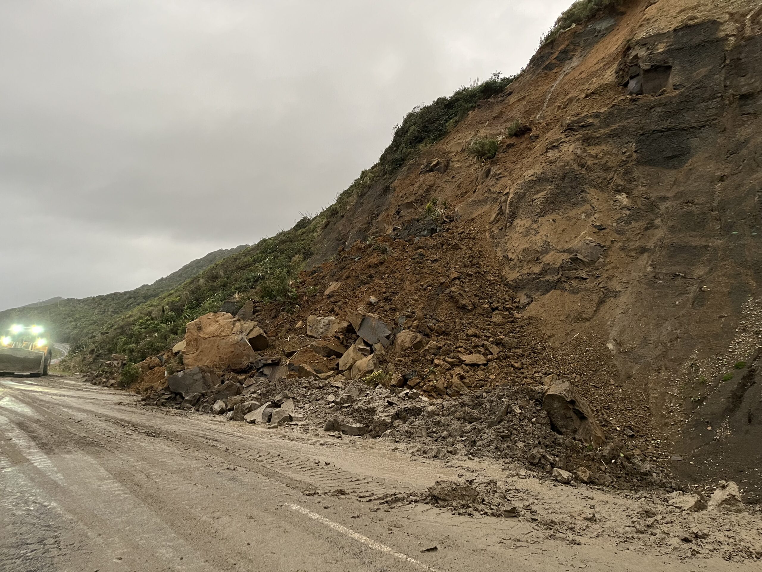
A person has been seriously injured on State Highway 75, Christchurch Akaroa Road. A police...

BodyFix Gym Christchurch in Phillipstown has taken out two major honours at the Exercise New...

Local MPs have found areas of agreement on major Resource Management Act reforms, during a...

A series of public events have been organised across Christchurch and Lyttelton over the coming...

A woman was taken to hospital after a ‘water incident’ at Parakiore Recreation and Sport...

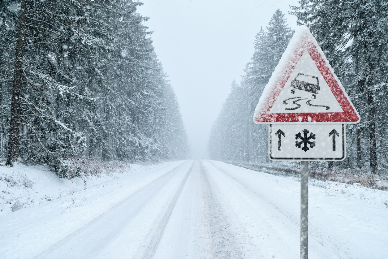
Environment Canterbury has issued a flood warning for several major alpine rivers after heavy rain throughout Thursday caused significant rises in water levels across the region.
In an update issued at 10.16pm on Thursday, the agency said rainfall in the headwaters of the Waiau-uha, Hurunui, Waimakariri, Rakaia, Rangitata, and Waitaki Rivers had eased, but high river flows were continuing to move downstream overnight.
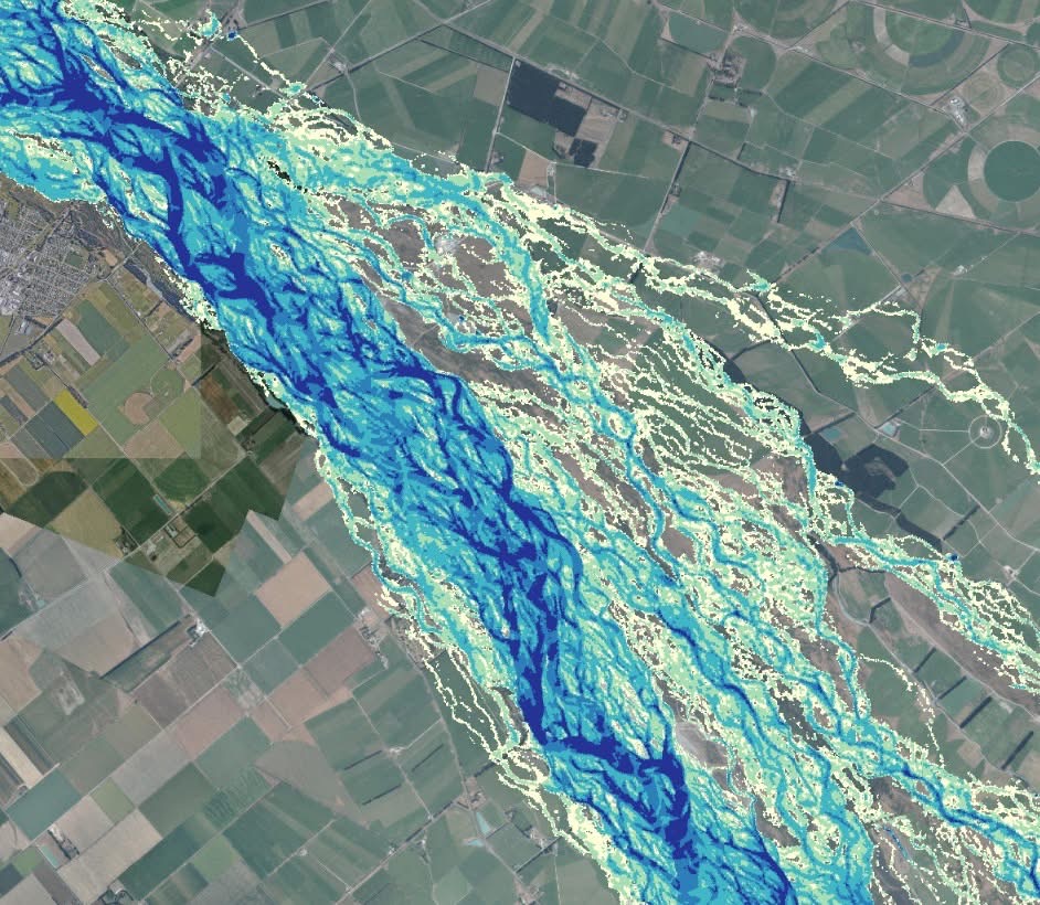
SH1 to Upper Rakaia Island
“Flows have risen in the upper catchments throughout the day, and these will travel through the lower parts of the rivers from this evening and overnight,” Environment Canterbury said.
The regional authority said it was continuing to monitor river flows and flood protection infrastructure and would provide another update by 9am Friday, or sooner if conditions changed.
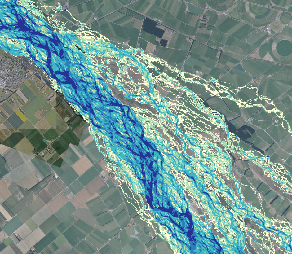
Upper Rakaia Island
Residents and farmers near affected rivers were urged to stay informed and take precautions. “We recommend that you stay up to date with the latest flooding information, and beware of increasing flows if you are working or recreating in affected riverbeds. Farmers adjacent to flood-affected rivers should consider moving stock away from vulnerable areas,” the agency said.
Waiau-uha River
Flows peaked around 85 cubic metres per second at Malings Pass, below Tuesday’s levels of about 115 cubic metres per second, but are still rising at Marble Point. Out-of-river flooding to nearby farmland remains possible.
Hurunui River
Flows peaked at about 1,050 cubic metres per second at Mandamus, higher than earlier in the week. Environment Canterbury said out-of-river flooding was likely on adjacent farmland overnight.
Waimakariri River
The Waimakariri River is experiencing high flood levels, with flows peaking at approximately 2,700 cubic metres per second above the Gorge. Elevated levels are expected to continue downstream overnight.
“As a precaution, we recommend that residents in Kairaki and Pines Beach begin preparing in case an evacuation becomes necessary,” Environment Canterbury said.
Residents in McLeans Island, Coutts Island, and Templars Island were also advised to be ready to leave if needed. “You will be notified if an evacuation is required. However, if you feel unsafe at any time, please don’t hesitate to leave early,” the agency said.
Rakaia River
Flows peaked around 4,800 cubic metres per second at Fighting Hill and are moving through the lower river. Out-of-river flooding to adjacent farmland and around State Highway 1 is possible.
“Together with Selwyn and Ashburton District Council Civil Defence, we are recommending voluntary evacuation of people and stock of adjacent areas,” Environment Canterbury said.
The advisory includes North and South Rakaia Huts and rural land downstream of State Highway 1.
Rangitata River
Flows were beginning to peak around 1,500 cubic metres per second at Klondyke. Out-of-river flooding into farmland and the South Branch is possible.
Ahuriri River
Flows peaked around 360 cubic metres per second at State Highway 8, with possible flooding at the SH8 campground.
Environment Canterbury said its teams would continue to monitor conditions overnight and urged residents to follow updates and take extra care near rivers.