Escaped youth tracked by Eagle helicopter, found hiding in New Brighton
The young person who escaped from a youth justice facility in Rolleston has been located...
Proudly powered by VAST – NZ’s leading digital advertising billboard company. FIND OUT MORE

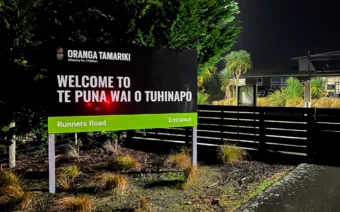
The young person who escaped from a youth justice facility in Rolleston has been located...

A person has been seriously injured on State Highway 75, Christchurch Akaroa Road. A police...

BodyFix Gym Christchurch in Phillipstown has taken out two major honours at the Exercise New...

Local MPs have found areas of agreement on major Resource Management Act reforms, during a...

A series of public events have been organised across Christchurch and Lyttelton over the coming...

A woman was taken to hospital after a ‘water incident’ at Parakiore Recreation and Sport...


Flooding and rising tides have forced the closure of key roads around Christchurch as heavy rain continues to affect the region.
As of Wednesday afternoon, New Brighton Road between Rawson Street and Pages Road, and Avonside Drive between Wainoni Road and Kerrs Road, are closed due to flooding, with more closures possible as conditions worsen.

SH1 GRETA VALLEY, CANTERBURY – SLIP:
Due to a slip BLOCKING a lane near the intersection with Stonyhurst Rd, STOP/GO traffic management with a 30km/h temp speed limit is in place. Photo: Sean Wilton
The Redcliffs Residents Association warned on social media that “exceptionally high evening tides” are expected tonight, Thursday night, and Friday night, with tide heights of 2.7, 2.6, and 2.6 metres respectively.
“Given the forecast ongoing heavy rain for the next 39 hours, there is likely to be extensive flooding in the lower parts of Sumner and Redcliffs,” the group said.
Tonight’s high tide in Lyttelton is expected at 6.42pm, with further peaks on Thursday at 7.12am and 7.41pm.
MetService has issued seven warnings and one watch across Canterbury and the South Island, with conditions likely to deteriorate through to Thursday night.
Heavy Rain Warning – Orange (North of Amberley)
From 10am Wednesday to 9pm Thursday
Up to 210mm of rain expected with a high chance of a Red Warning upgrade.
Dangerous river conditions, flooding, slips, and possible power outages are expected.
Advice: Avoid travel, stay alert, and be prepared to evacuate if necessary.
Heavy Rain Warning – Orange (Christchurch, Banks Peninsula, Amberley to Timaru)
From 10am Wednesday to 6pm Thursday
Up to 160mm of rain expected about the foothills.
Advice: Clear drains and avoid low-lying areas. Caution is advised on the roads.
Heavy Snow Warning – Orange (South of the Rangitata River)
From 9pm Wednesday to 9am Thursday
Up to 20cm of snow expected above 800 metres.
Advice: Expect travel disruption, prepare for cold conditions and possible power outages.
Road Snowfall Warnings:
Lewis Pass (SH7): 2–5 cm of snow
Arthur’s Pass (SH73): 1–3 cm
Porters Pass (SH73): 10–15 cm
Lindis Pass (SH8): 1–3 cm
Strong Wind Watch (West Coast and Nelson Lakes)
From noon Wednesday to 3pm Thursday
Southeast winds may reach severe gale in exposed areas.
Advice: Secure outdoor items and take care on the roads.
Authorities are urging residents not to drive through floodwaters and to avoid unnecessary travel. The National Emergency Management Agency has advised people to be prepared for power outages and potential evacuation in flood-prone areas.