Escaped youth tracked by Eagle helicopter, found hiding in New Brighton
The young person who escaped from a youth justice facility in Rolleston has been located...


The young person who escaped from a youth justice facility in Rolleston has been located...

A person has been seriously injured on State Highway 75, Christchurch Akaroa Road. A police...

BodyFix Gym Christchurch in Phillipstown has taken out two major honours at the Exercise New...

Local MPs have found areas of agreement on major Resource Management Act reforms, during a...

A series of public events have been organised across Christchurch and Lyttelton over the coming...

A woman was taken to hospital after a ‘water incident’ at Parakiore Recreation and Sport...

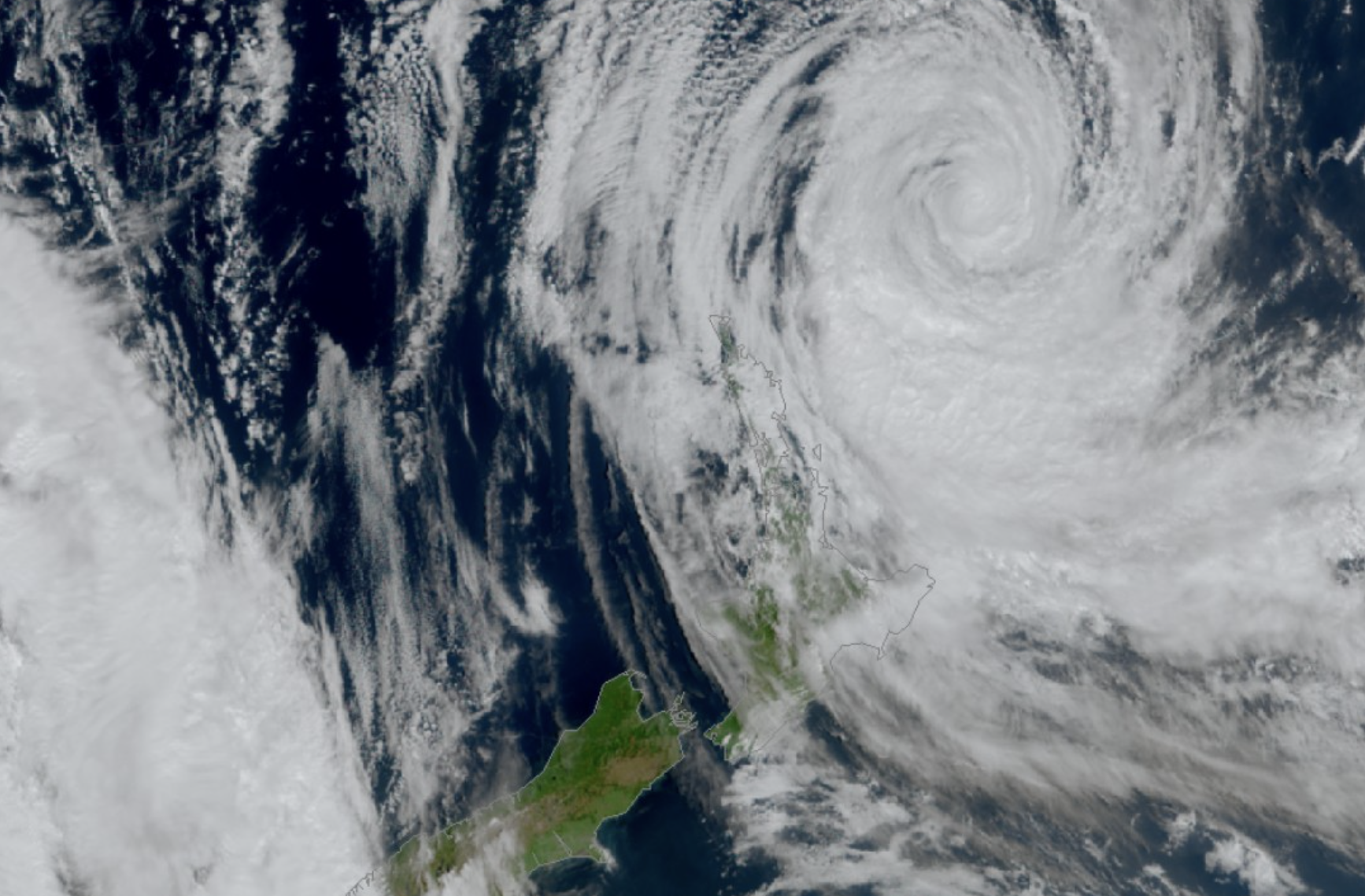
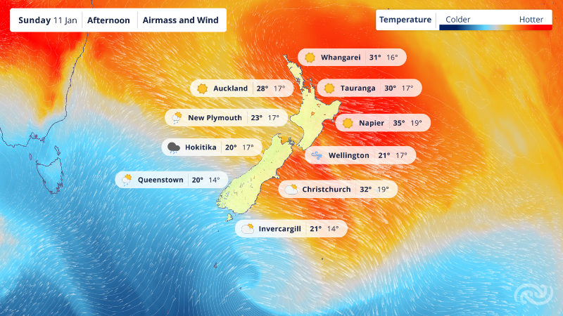
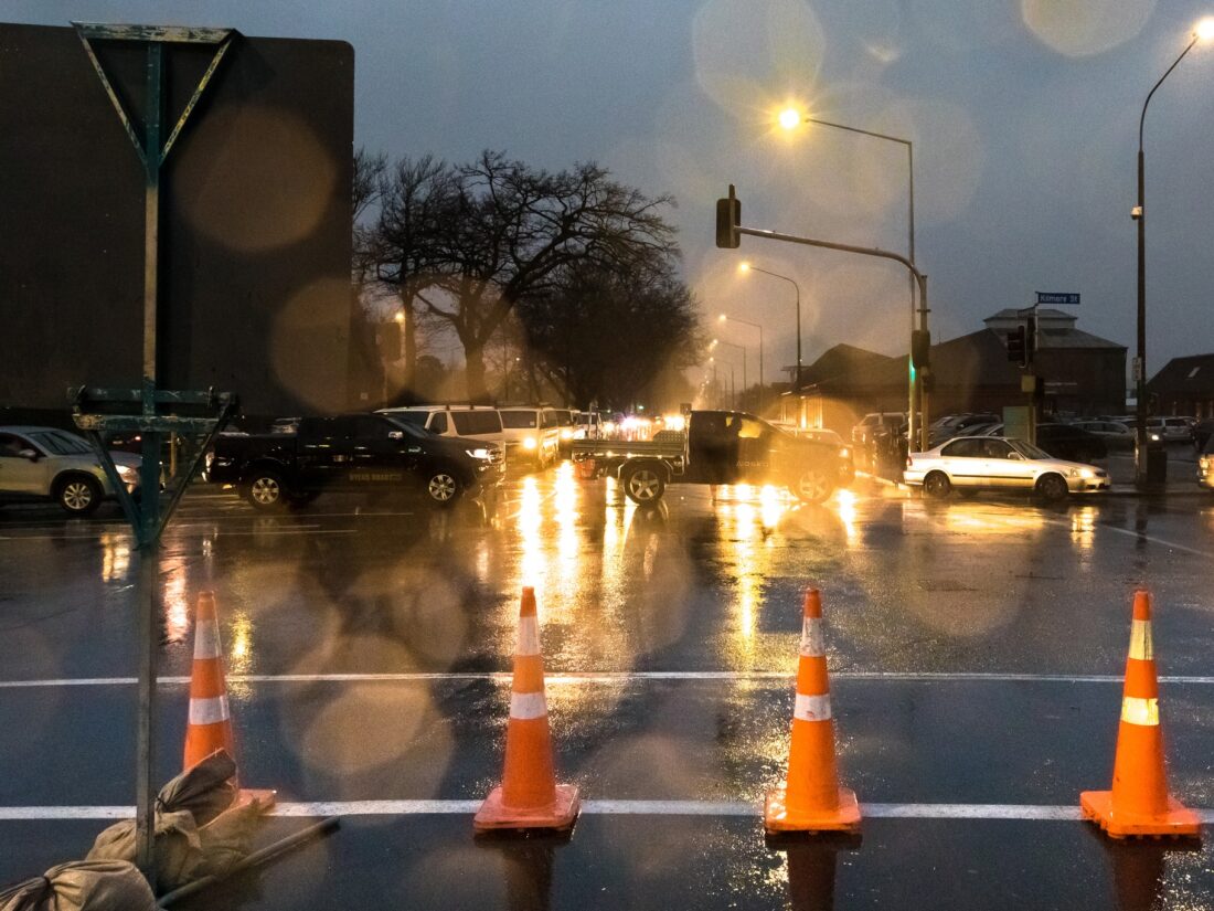
Rain has eased across Canterbury, but some flooding concerns remain as stormwater basins near capacity and overflow continues along parts of the Heathcote River.
Christchurch City Council said the basins, designed to reduce flooding, are now full or nearly full, increasing flood levels in the upper Heathcote. Some properties are already affected.
“We’re actively monitoring the water levels in the Heathcote River and will do our best to limit any impacts on residents overnight,” the Council said. Water levels are expected to fluctuate over the coming days as managed basin releases continue.
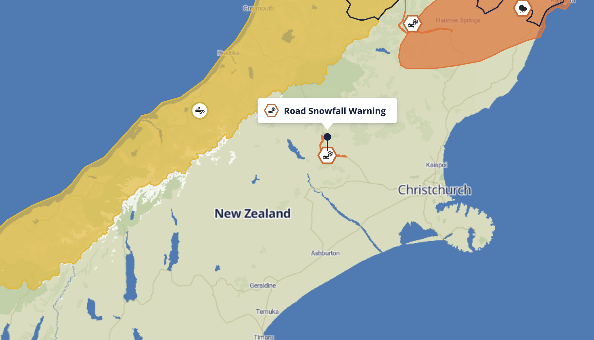
Dyers Pass Road closed as slips and flooding disrupt travel
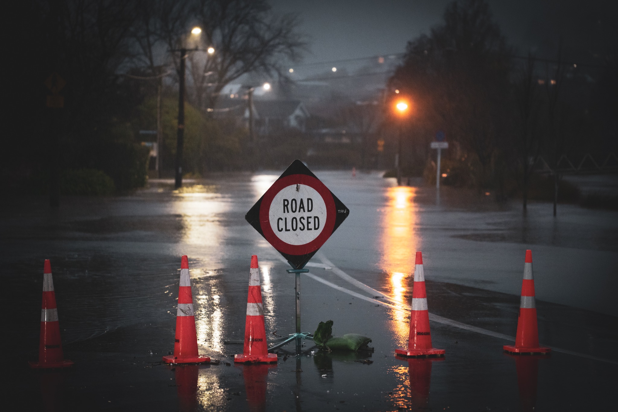
A slip has closed Dyers Pass Road from the Sign of the Takahe to Governors Bay. Residents are being urged to avoid travel unless absolutely essential, with the Council warning: “Do not drive through flooded areas—you don’t know what’s under the water.”
Drivers are also asked to slow down and avoid pushing water onto people’s properties. Slips and fallen trees remain a risk in hilly areas.
If you can’t get home tonight or need shelter, the Council is asking people to contact its call centre on 03 941 8999 or 0800 800 169.
Christchurch / Christchurch City Council
State of emergency remains in place
A local state of emergency was declared for Christchurch and Banks Peninsula at 4PM. Mayor Phil Mauger said the decision was made to ensure resources could be deployed quickly.
“The weather hasn’t eased as we hoped,” Mauger said. “Declaring a state of emergency means we’re ready for whatever happens overnight.”
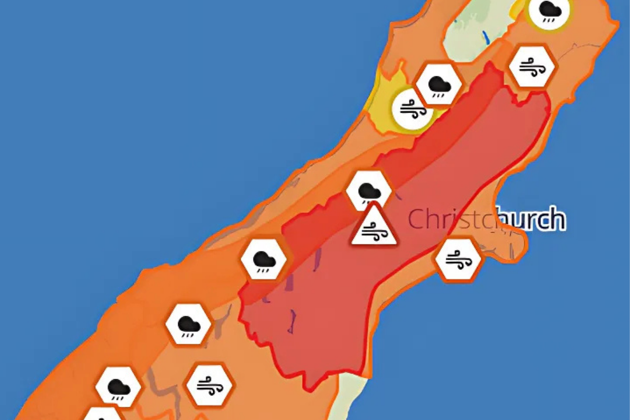
Dozens of roads closed across Christchurch and Banks Peninsula
Road closures remain widespread across Christchurch and Banks Peninsula, particularly in flood-prone and hillside areas. Key closures in South Christchurch include:
Cashmere Road to Sutherlands Road
Hendersons Road from Sparks Road to Cashmere Road
Ford Road
Summit Road – Sign of the Kiwi to Gebbies Pass Road
Multiple riverfront roads including Ernlea, Hunter, Clarendon, Richardson, Eastern, Riverlaw, and Palatine Terraces
Banks Peninsula has also been hit hard, with roads closed due to flooding and slips, including:
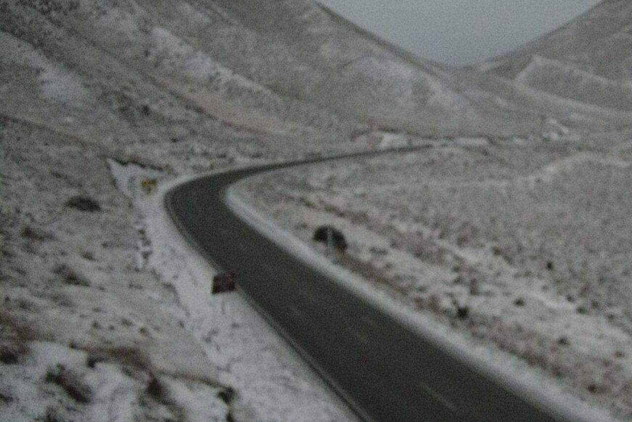
SH75 from Tai Tapu to Akaroa
Gebbies Pass Road
Bossu Road
Reynolds Valley Road
Kinloch Road
Le Bons Bay Road
Port Levy Pigeon Bay Road
Stony Bay Road
Peraki Road
Hurunui District monitoring conditions as warning lifted
Hurunui District Council said MetService has now lifted the Orange Heavy Rain Warning for areas about and north of Amberley and south of the Waiau River, as rain begins to ease. However, a Heavy Rain Warning remains in place north of the Waiau River.
The Council urged continued caution across the district, with surface flooding still present.
“A significant amount of rain has fallen, with 110mm recorded in Amberley. Surface flooding and ponding will take time to fully clear,” the Council said.
Infrastructure and public services affected
The Little River Library and Customer Service Hub remains closed due to flooding, expected to reopen Friday.
Water conservation is encouraged in Akaroa, Takamatua, and Duvauchelle, where rainfall may impact supply.
Christchurch’s wastewater system is under pressure, with some residents experiencing slow drainage. The Council said cleanup support is available in the event of overflows.
Public health reminder
Residents are strongly advised to stay out of floodwaters, which may be contaminated. Even shallow water can be dangerous, and proper hygiene is essential after any exposure.