Escaped youth tracked by Eagle helicopter, found hiding in New Brighton
The young person who escaped from a youth justice facility in Rolleston has been located...


The young person who escaped from a youth justice facility in Rolleston has been located...

A person has been seriously injured on State Highway 75, Christchurch Akaroa Road. A police...

BodyFix Gym Christchurch in Phillipstown has taken out two major honours at the Exercise New...

Local MPs have found areas of agreement on major Resource Management Act reforms, during a...

A series of public events have been organised across Christchurch and Lyttelton over the coming...

A woman was taken to hospital after a ‘water incident’ at Parakiore Recreation and Sport...


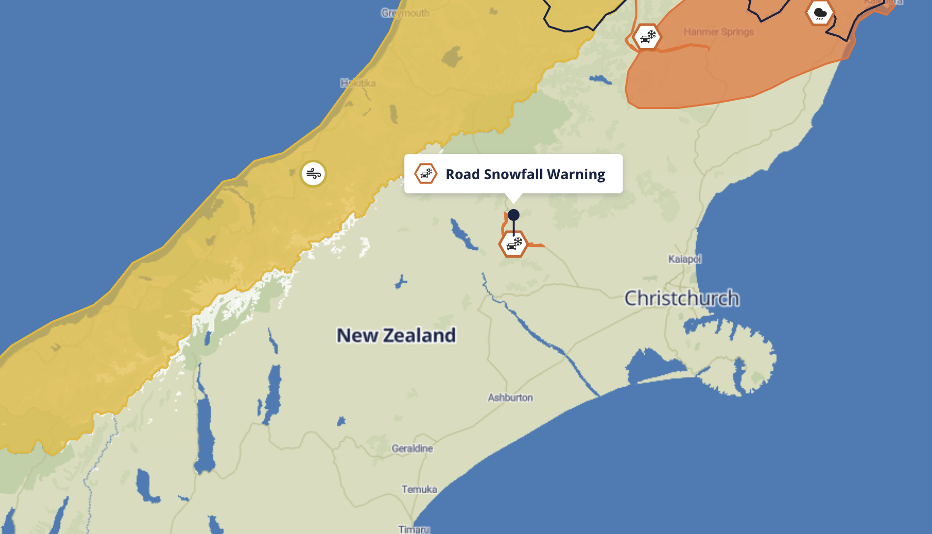
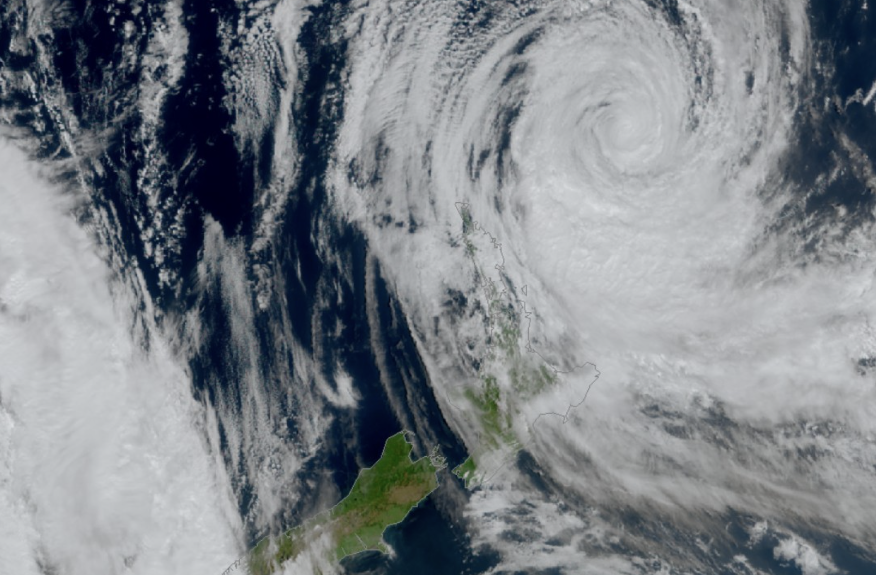
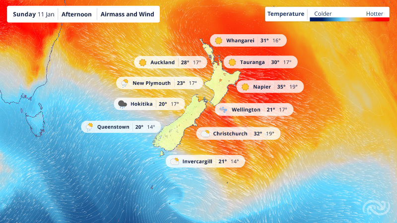
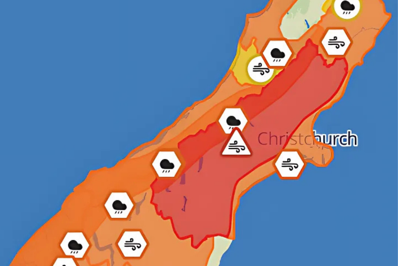
Flooding has forced widespread road closures across Christchurch and Banks Peninsula, while heavy rain continues to put pressure on local water and wastewater networks.
A Christchurch City Council spokesperson said teams are closely monitoring the impact of the storm on water supplies, particularly in Akaroa, Takamatua and Duvauchelle.
“We’re currently in a good position and all our reservoirs are full,” the spokesperson said. “While the situation is stable, heavy rain events are unpredictable and we encourage residents to be mindful of water use and conserve where possible.”
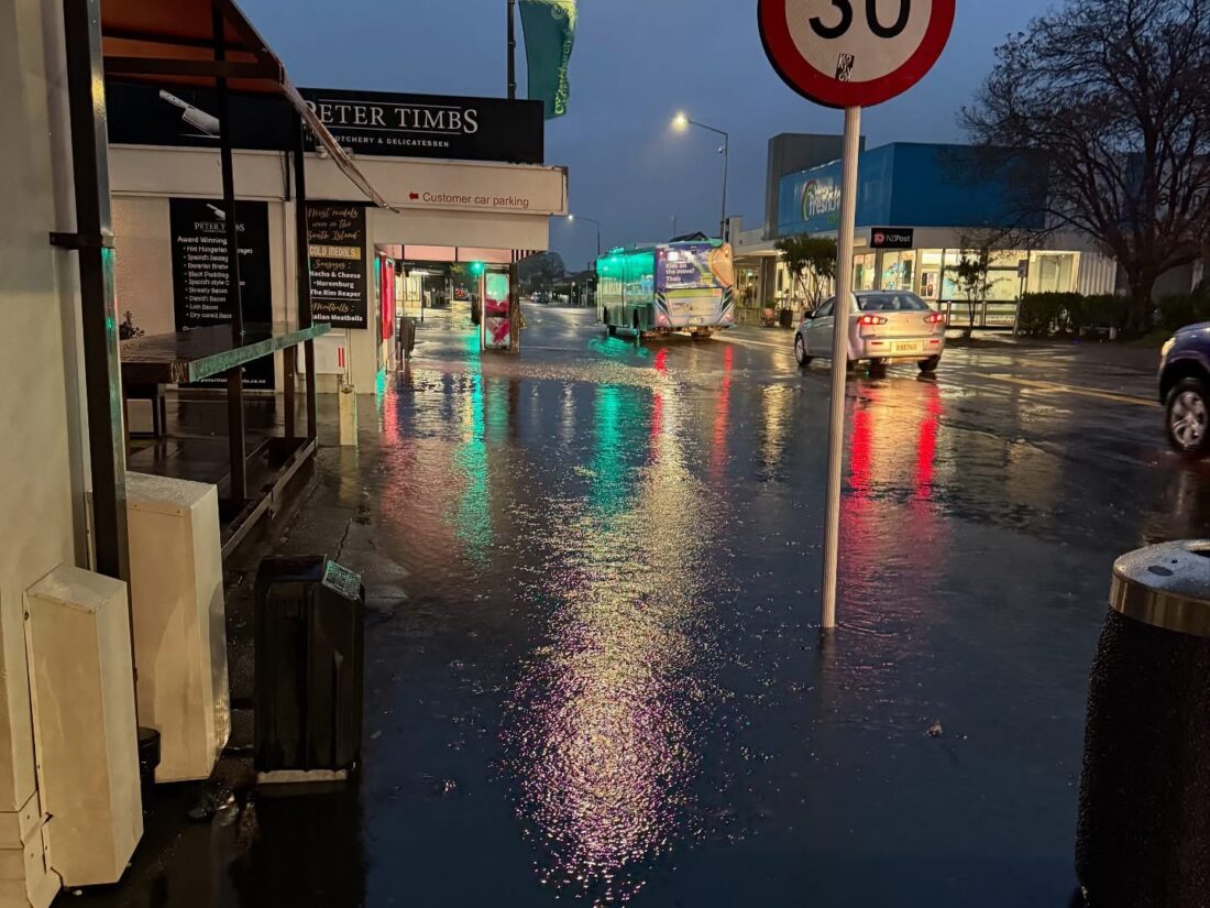
Peter Timbs Meats
The council said staff and contractors are available around the clock to respond to any issues. Updates will be provided via Facebook and the Newsline live-blog if pressure on water supplies increases.
Heavy rainfall is also affecting the wastewater network. In some areas, toilets, sinks and showers may drain slowly—or not at all. If this occurs, the council said clean-up operations will be arranged once notified.
Flooding has also closed numerous roads across the region.
Christchurch city closures include:
Banks Peninsula closures include:
The council also confirmed Lyttelton’s organics kerbside collection will be impacted today due to weather.
Ahead of the rain, council contractors cleared gutters, sumps, and stormwater grates, and are continuing to manage water levels in the Ōpāwaho Heathcote River. The city’s stormwater network is designed to use roads as secondary flow paths, which may lead to visible surface flooding during heavy rain.
The council urged residents to avoid unnecessary travel and keep an eye on official updates.